Sicily’s WWII Landing Beaches: An Engineer’s Reading
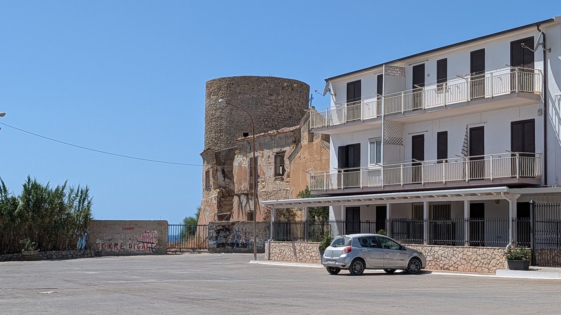
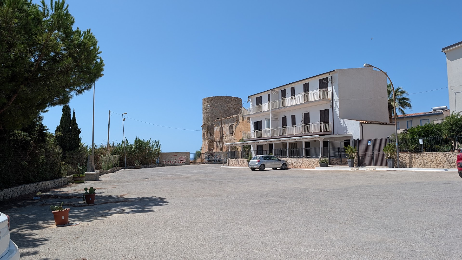
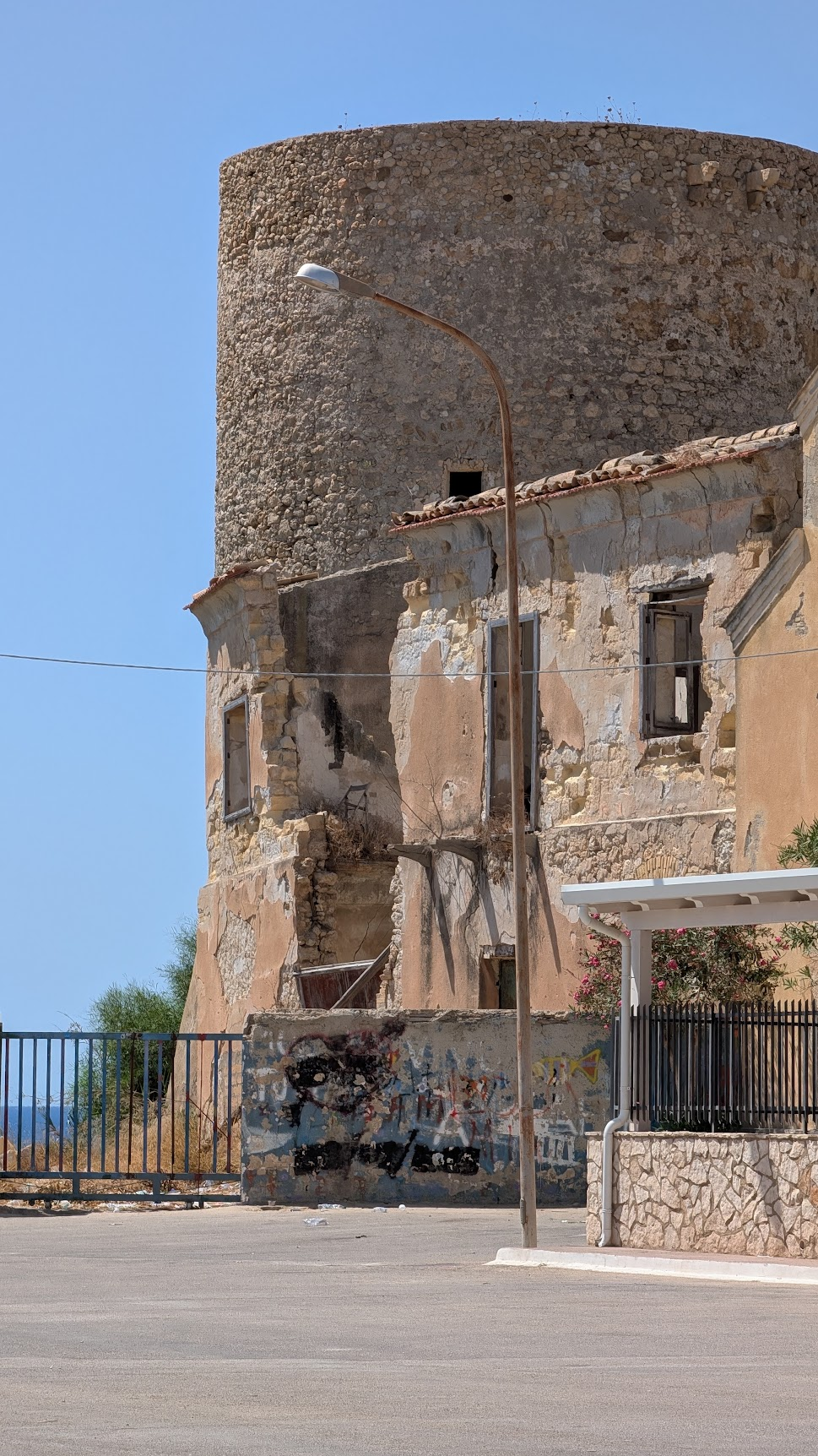
At noon in August, the light over Torre di Gaffe is flat and white. It erases shadows and softens every edge into a single glare. The tower stands about eleven meters above a beach called Ciotta. Its circular walls are losing patches of lime plaster to the salt air, one season at a time. A gravel parking lot has grown up against its base. A squat white house leans into the tower’s western flank, close enough to touch both with your arms out. On the low retaining wall that holds back the dune, someone has sprayed a name in red paint, half covering an older name in blue. None of this looks like a battlefield. That is the point. It is also the problem for anyone who arrives here with a grandfather’s photograph in hand, expecting the ground to explain itself.
Sicily’s WWII landing beaches run along roughly forty miles of the island’s southern coast. Here, the U.S. Seventh Army came ashore before dawn on July 10, 1943, in Operation Husky. The main sectors run west to east. At Licata, Red, Green, and Blue Beaches were held by the U.S. 3rd Infantry Division. At Gela, the 1st Infantry Division and Army Rangers landed. At Scoglitti, the 45th Infantry Division came ashore, with fighting continuing east toward Santa Croce Camerina and Punta Secca. All of these beaches are open to the public today. None of them sit inside an organized visitor circuit. What survives is scattered: a handful of monuments, a few restored Italian coastal bunkers, and three sixteenth-century watchtowers that were already standing guard on the morning the invasion began.
What the Stone Says
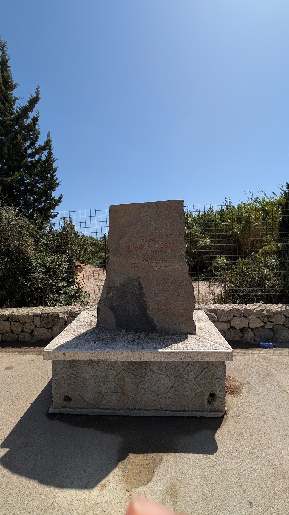
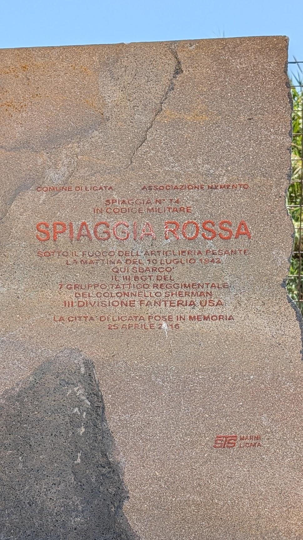
At the eastern end of the beach, past the tower, a granite marker records what happened here. It uses the language of 1943, and it assumes the reader already knows that vocabulary. The comune of Licata and the Associazione Memento placed it on April 25, 2016 — Italy’s Liberation Day, a date chosen on purpose. The plaque names the beach twice: Spiaggia Rossa in plain language, and “Spiaggia N. 74 in codice militare,” Beach No. 74 in the military code used for the invasion itself. It names Colonel Sherman. It names the 7th Regimental Combat Team, part of the 3rd Infantry Division. And it states plainly that the landing here happened under heavy artillery fire on the morning of July 10, 1943. To an American descendant standing here with a family photograph in one hand, the inscription still reads like a locked door.
Here is the key. A Regimental Combat Team, usually shortened to RCT, was not simply an infantry regiment. It was a stand-alone fighting unit, built around one regiment — in this case the 7th Infantry. It carried its own field artillery battalion, its own combat engineers, and its own medical detachment. That way, it could land, fight, and hold ground on its own, before the rest of the division caught up. Three such combat teams made up the 3rd Infantry Division, built around the 7th, 15th, and 30th Infantry Regiments. All three came ashore across Licata’s beaches before first light on July 10. Truscott commanded the division. Sherman commanded the 7th RCT as a whole; the plaque is specific that it was the RCT’s III Battalion that actually landed on this stretch of sand. That kind of precision — a whole regiment’s worth of history compressed into a single battalion number — only makes sense once you already know the system behind it.
I have spent thirty years reading documents written by specialists for other specialists: structural drawings, geotechnical reports, energy certifications. This plaque belongs to the same family. Even its abbreviations give it away: “III BGT” for third battalion, “7° Gruppo Tattico Reggimentale” for the 7th RCT, shorthand that only works if you already carry the full term in your head. It was not built to explain Operation Husky to a stranger. It was built by people who had lived the events it describes, for other people who already knew the outline. That is worth saying plainly to a visitor standing here for the first time. You are not missing something obvious. The stone was simply never written for you, and it will not meet you halfway.
The Tower
Torre di Gaffe was not built with this war in mind. That fact is the most useful thing to understand about it. It went up in the first half of the sixteenth century, one link in a chain of Sicilian watchtowers. Their job was to spot Barbary corsairs before a raiding party could reach the beach. The Duke of Gaffe paid for its construction. His family, the Grugno, were nobles of Catalan origin who had settled in this part of Sicily generations earlier. The tower protected both his farmland and the small anchorage at Spiaggia Ciotta below it. From the parapet, a lookout could see Torre San Nicola to the east and the Castellazzo di Palma to the west. A fire or smoke signal could pass an alarm down the coast faster than any rider on horseback.
The tower is circular, just under ten meters across, and rises about eleven meters above the beach. It carries a formal monumental protection order today. The province’s own architectural survey describes its structure as sound, even where the rendered lime surface has worn down to bare stone in patches. That distinction matters more than it sounds like it should. A structure can lose its skin and keep its bones. That is a very different problem from losing the bones themselves. I have spent three decades explaining that difference to clients, usually while standing in front of something far less photogenic than a Renaissance watchtower.
Nobody built this tower to help an invasion. Yet on the night of July 10, 1943, its silhouette became useful for exactly that. It was a known, mapped, four-century-old landmark. A landing-craft coxswain running blind in the dark needed exactly that kind of fixed point, while correcting for current and searching for the right stretch of coast. The tower did not take a side that night. It simply kept standing where it had always stood, and that made it useful to whoever needed a reference point.
The building actually in trouble here is not the tower at all. It is the low, roofless structure attached to its western side. Judging by its poured-concrete lintels, it is a twentieth-century addition. It is now missing most of its roof and half its render, and its exposed walls are layered with spray paint. Fewer than a hundred years separate this building’s construction from its present ruin. The tower took over four centuries to reach a comparable state of undress. By the province’s own assessment, it never lost its structural integrity in the process. If there is a lesson here about what lasts and what does not, it has less to do with age than with how a thing was built in the first place.
The Bunker
Follow the coast east from Licata, past Gela, past the mouth of the Dirillo River. Here, the defensive works change character. These are not watchtowers built to spot ships from a distance. They are firing points built to stop men from crossing the last thirty meters of open sand.
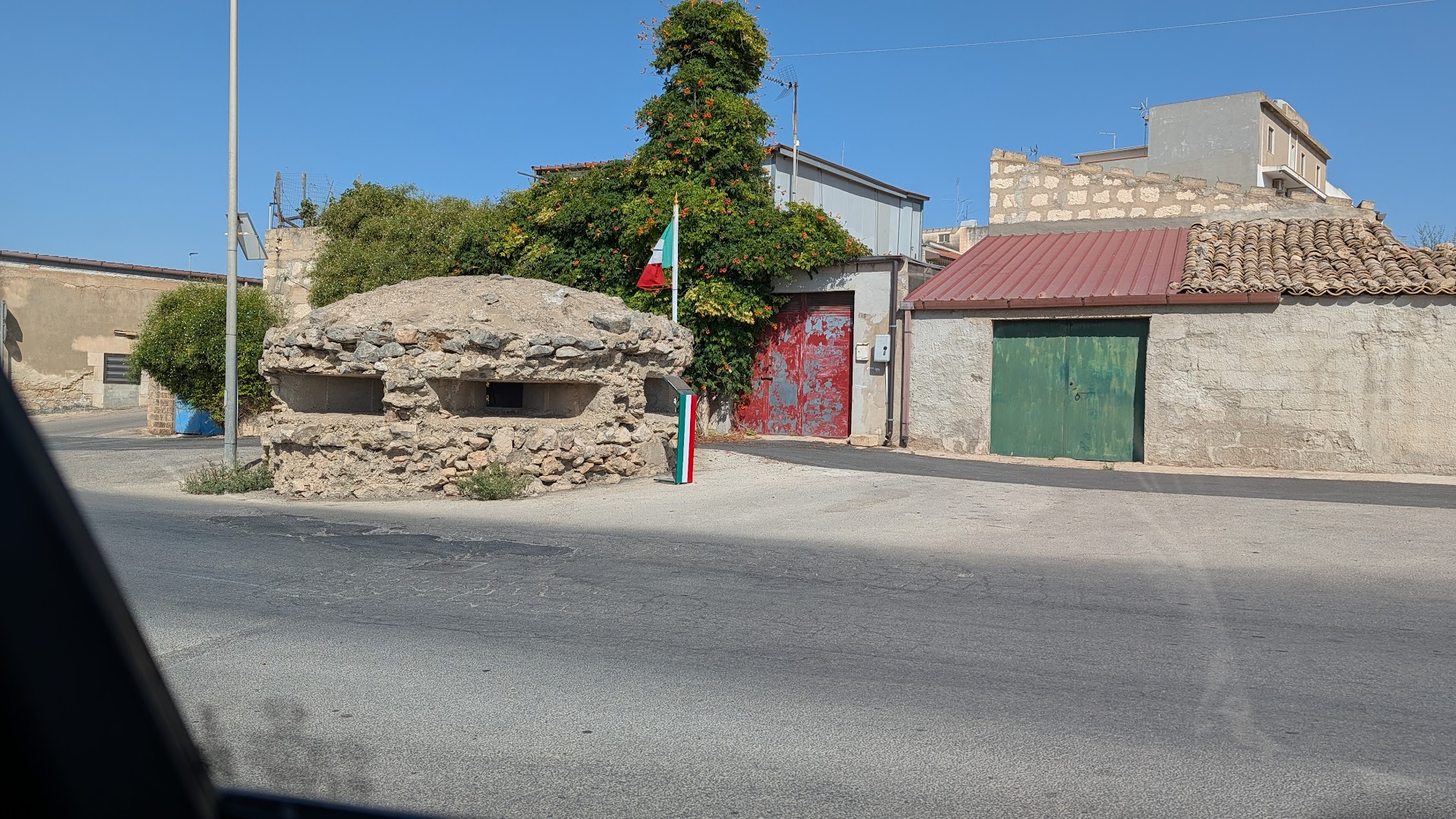
The one at contrada Filippello, in the territory of Santa Croce Camerina, is a small reinforced-concrete casemate. It is faced in rough, uncut local stone — pietrame ciclopico, in the vocabulary I use on-site with clients. The stone facing breaks up the box outline of the poured concrete. From the water or the air, it reads as an unremarkable stretch of dry-stone field wall. That was the standard camouflage logic Italian military engineers applied along much of this coast in 1942 and 1943. Concrete does the structural work. Stone does the disguise. A single narrow firing slit is the only real tell, angled to rake the beach at grazing height rather than aim out to sea. Inside, the space is cramped by design. There is room for a machine-gun crew and their ammunition, no more. A smaller silhouette meant a smaller target, and a tighter field of fire along the sand.
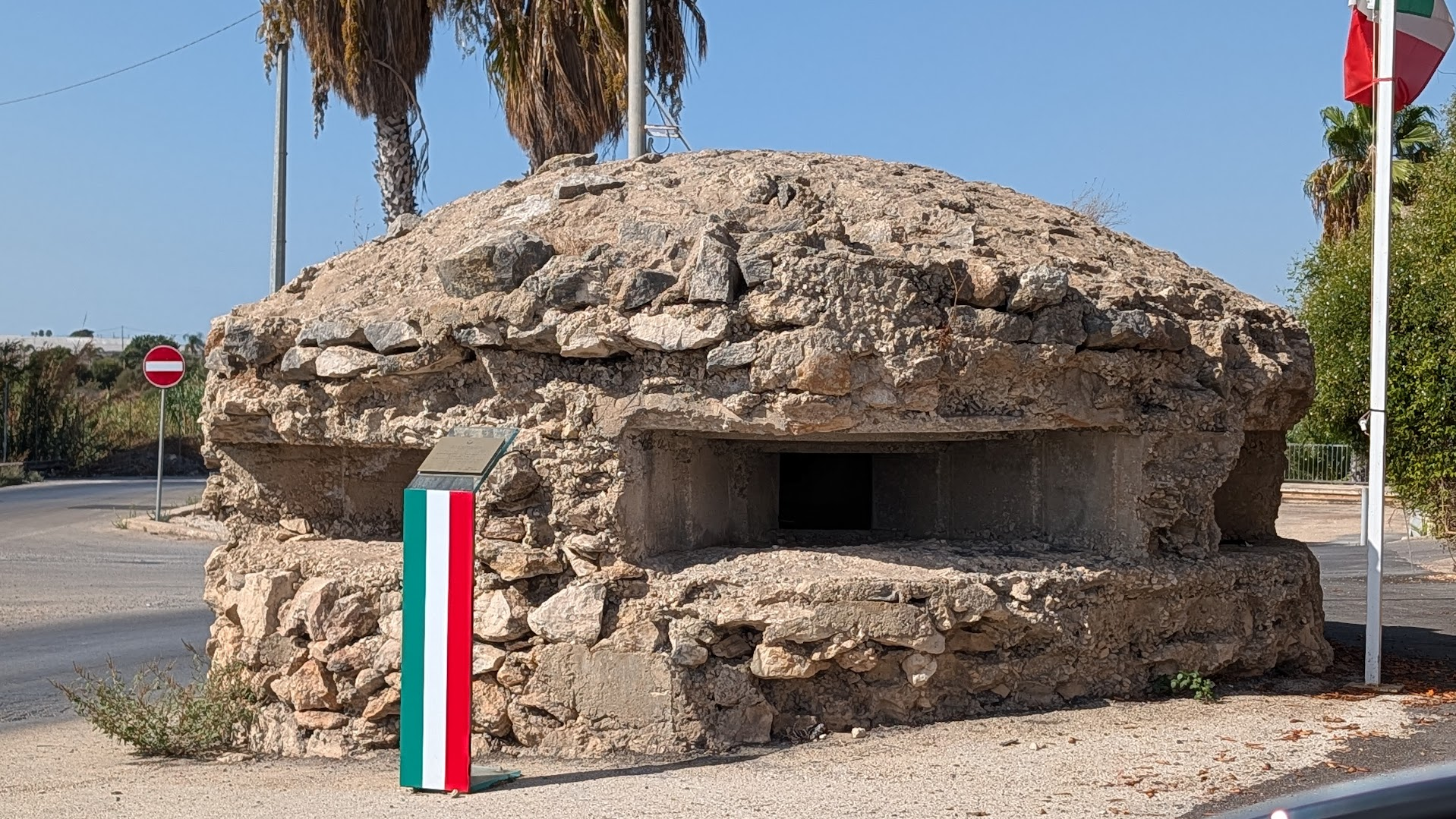
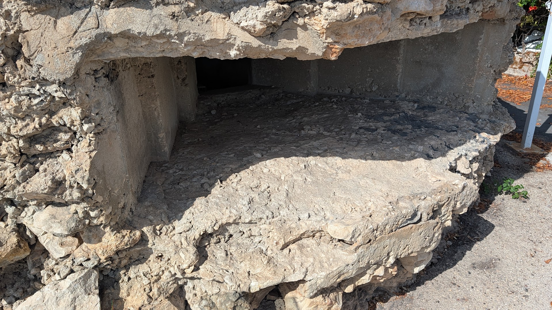
Research into the Santa Croce Camerina sector points to a specific unit here. On the morning of July 10, 1943, this stretch of coast was defended by the 383rd Coastal Battalion, under Lieutenant Colonel Francesco Milazzo. He was reinforced by a detachment of Carabinieri and roughly fifteen civilian volunteers, who took up rifles and hand grenades for the day. I have not been able to independently confirm which larger coastal division this battalion answered to. I am noting that gap rather than filling it. [VERIFY] What is not in question is who most of these men were: Sicilian conscripts, defending their own home shore. That detail tends to get lost when the story is told only from the American side of the beach.
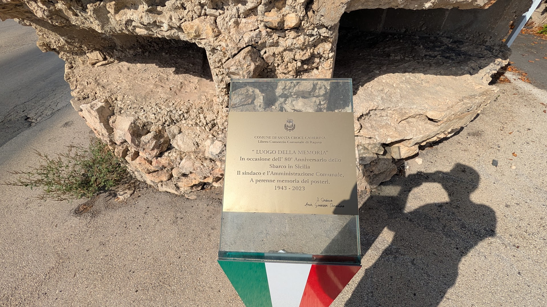
For most of eight decades the position sat abandoned, one more concrete box in a field. That started to change in 2023, the eightieth anniversary of the landing, when the comune fixed a plaque to the stonework: “Luogo della Memoria,” it reads, placed by the mayor and town council “a perenne memoria dei posteri,” for the enduring memory of those who come after. It is signed by the mayor of the time, Arch. Giuseppe Dimartino. Three years later, in July 2026, the same administration finished the job the plaque had only promised: a full recovery project, carried out with the local association Fare Ambiente, that cleared the site and reopened its interior to visitors. Dimartino, still in office, called it the third structure of its kind recovered during his term. A wreath went down for the town’s own war dead. A Carabinieri veterans’ band played. A priest spoke about memory as an obligation to the future, not just a monument to the past. Between them, the plaque and the restoration do something no single marker could: they treat the bunker as belonging to Santa Croce Camerina’s own history first, and only secondarily to the Americans who fought their way past it.
Punta Secca
Eleven kilometers east of the Filippello bunker, the coast turns into something else entirely. Punta Secca’s beach draws its current crowd from television, not war history. For two decades, this stretch has stood in as Marinella, the fictional home of Commissario Montalbano. The small piazza beside Torre Scalambri fills every summer with visitors photographing a police detective’s house that exists only on screen.
The tower itself long predates the fiction. Torre Scalambri went up in 1593–94, commissioned by Giovanni Cosimo Bellomo, a Syracusan noble. Its job was to defend the small anchorage below it from Barbary raiders. A 2013 restoration stripped away a century of private modifications: balconies, and glass doors cut through what had originally been firing slits. The work returned the tower to something closer to its early silhouette. Today its ground floor serves espresso to the same crowd that comes for Montalbano — a smaller, quieter claim to fame than Palermo’s own coffee tradition, but part of the same island habit of taking coffee seriously. The water here stays shallow for a good distance before it deepens, and the sand is fine and pale.
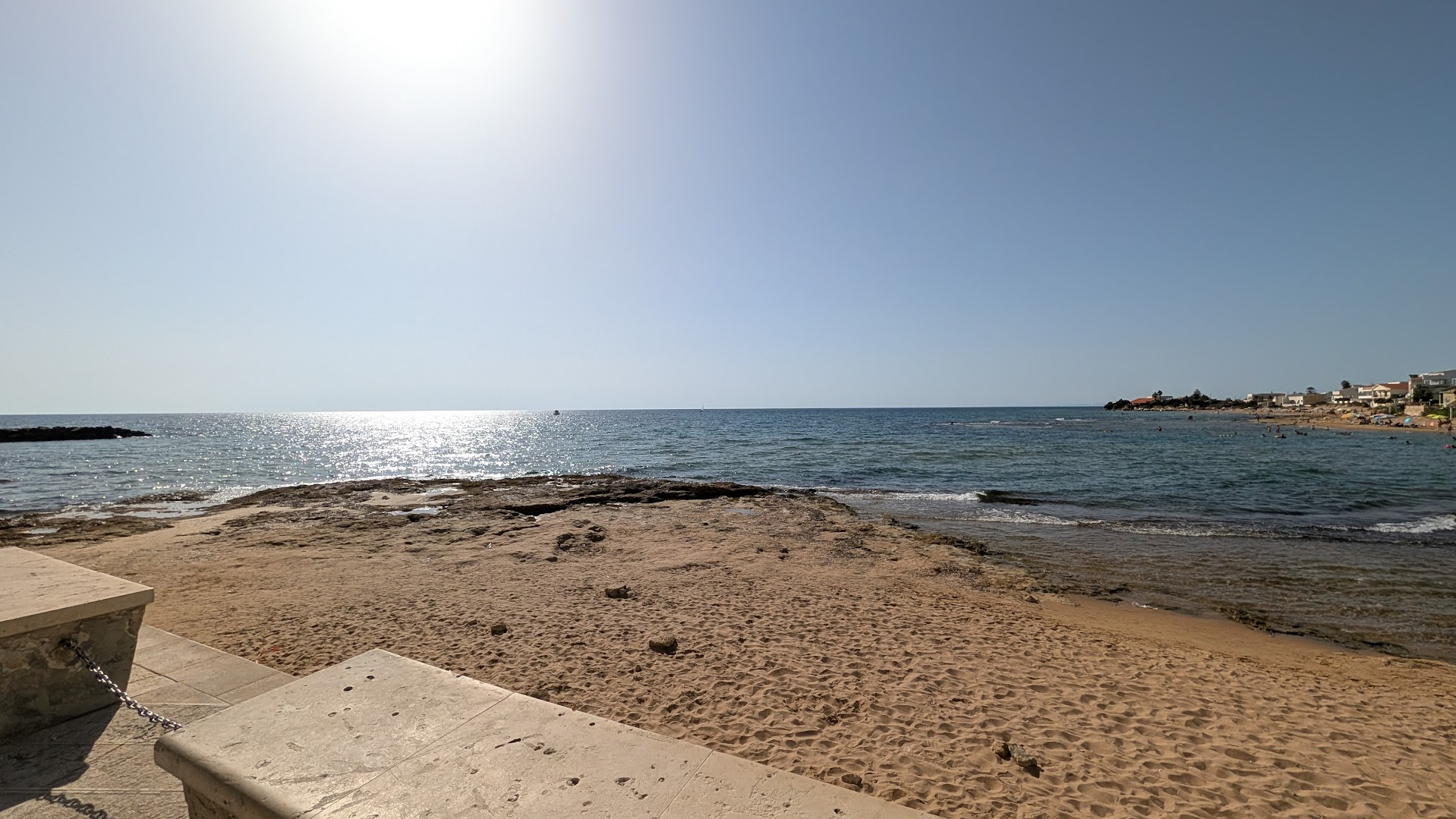
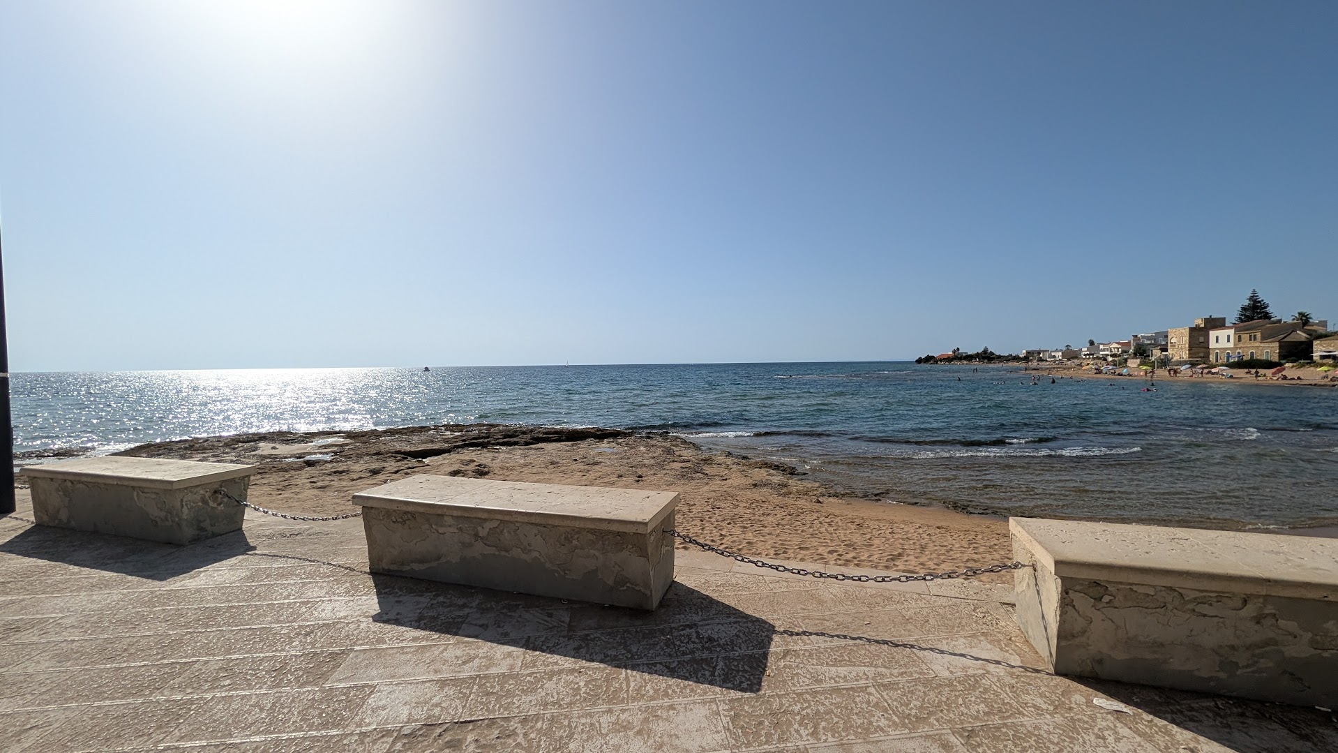
In July 1943, none of that mattered yet. The coast running east from here, toward Scoglitti and the mouth of the Dirillo River, fell inside the landing zone of the U.S. 45th Infantry Division. This same short stretch of shoreline, which today holds sunbeds and a gelato kiosk, was a fortified line on the defense maps of the time. I am not going to draw a moral from that contrast. I will only say that both things are true of the same thirty meters of sand, eighty-three years apart. A visitor who knows only one of them is seeing half the place.
How to Actually Visit
There is no single “landing beaches” route with brown tourist signage carrying you from stop to stop. You will need a car, a working navigation app, and patience with rural Sicilian roads. They do not always match what the app shows on screen.
Base yourself in Licata or Gela if the western sector interests you most. Choose Ragusa or Scicli if you are drawn to the Santa Croce Camerina and Punta Secca side instead — both towns also put you close to Noto, whose spring flower festival I have written about elsewhere on the blog and which pairs naturally with a shoulder-season trip to this coast. The two clusters sit roughly fifty kilometers apart along the coast, about fifty minutes by car with no traffic. It takes longer in summer, when the coast road backs up around every beach town along the way. Licata to Torre di Gaffe is a fifteen-minute drive. Santa Croce Camerina to Punta Secca is closer to ten.
Avoid July and August, unless the tenth of July itself is the point of your visit. The heat along this coast in midsummer is not the dry heat of the interior. It is heavy, humid, and unbroken by shade at most of these sites. The beaches are also at their most crowded exactly when you want quiet, to read a plaque or stand inside a bunker. May, June, September, and October give you the same light without the crowd or the heat — September in particular has its own rhythm on this coast, once the summer crowds have gone home.
If you do come for the anniversary, expect small, sincere, local ceremonies rather than reenactments or spectacle. There will be a wreath, a band, a mayor’s short speech, veterans’ associations standing at attention. Santa Croce Camerina’s 2026 commemoration at the Filippello bunker is a fair model of what these events actually look like. They are modest and civic, oriented toward the town’s own memory as much as toward any visiting descendant.
I am developing a separate consulting service, working title Grandfather’s Route. It is for American descendants who want an itinerary built around one specific unit, or one specific relative’s service record, rather than a general tour of the invasion. It is not bookable yet. If that is what brought you to this article, it is worth checking back on the blog before you plan the trip.
FAQ — Visiting Sicily’s WWII Landing Beaches
Where exactly is Red Beach, and can you walk on the beach itself? Red Beach lies at Torre di Gaffe, about six kilometers west of central Licata, in the small frazione that shares the tower’s name. The beach is public, and you can walk on it freely. A small monument and the granite marker sit near the tower, at the eastern end of the beach.
How do I find out which unit my grandfather served in? Start with whatever family papers survive. Look for separation papers, photographs with a visible unit patch, or letters carrying an APO number. A fire at the National Personnel Records Center in St. Louis, on July 12, 1973, destroyed an estimated 16 to 18 million official military personnel files. It destroyed roughly 80 percent of Army records covering discharges between 1912 and 1960. A negative search result there is common, and it does not automatically mean the record never existed. The National Archives keeps alternate sources, such as morning reports and pay vouchers, that can often reconstruct a service outline.
Are there American cemeteries or memorials in Sicily? No permanent American military cemetery remains on the island itself. The Sicily-Rome American Cemetery, despite its name, is located in Nettuno, near Anzio. That is roughly 38 miles south of Rome, on the Italian mainland. Temporary wartime cemeteries in Sicily were consolidated there after the war, along with cemeteries from the later Anzio and Rome campaigns.
Do I need a guide? Not strictly, but a local guide who knows this sector helps. A guide can find positions that carry no signage, and explain what you are looking at once you arrive. If you travel independently, download offline maps before you go. Several of these sites sit in stretches of coast with unreliable mobile signal.
How many days does this sector need? Two full days cover the ground comfortably. That gives you time for both the Licata sector and the Santa Croce Camerina–Punta Secca sector without rushing. One long day is workable if you are focused on a single town, where you know a specific relative landed.
Can you go inside the bunkers? At Filippello, yes. The 2026 restoration reopened the interior to visitors, during the comune’s stated opening hours. It is worth checking locally, since access can depend on ongoing custodianship arrangements. Most other coastal positions along this stretch remain sealed, overgrown, or on private land. View these from the outside only.
—