Cycling Le Marche Wine Country: An Insider’s 2026 Guide
Start climbing out of Numana at seven in the morning in June, before the beach umbrellas open, and the first thing you smell is not the sea. It is dust, warm stone, and something green and bruised — crushed fennel growing wild along the shoulder of the road. The Adriatic is still behind you, flat and silver through the gaps in the pine trees, and ahead the road bends inland toward Sirolo and disappears into vineyard rows that climb the flank of Monte Conero like a staircase. This is cycling Le Marche wine country: five distinct wine territories stacked between the Adriatic Sea and the spine of the Apennines, almost none of which appear on the American cyclist’s mental map of Italy, and all of which are rideable in a week without ever seeing another tour bus.
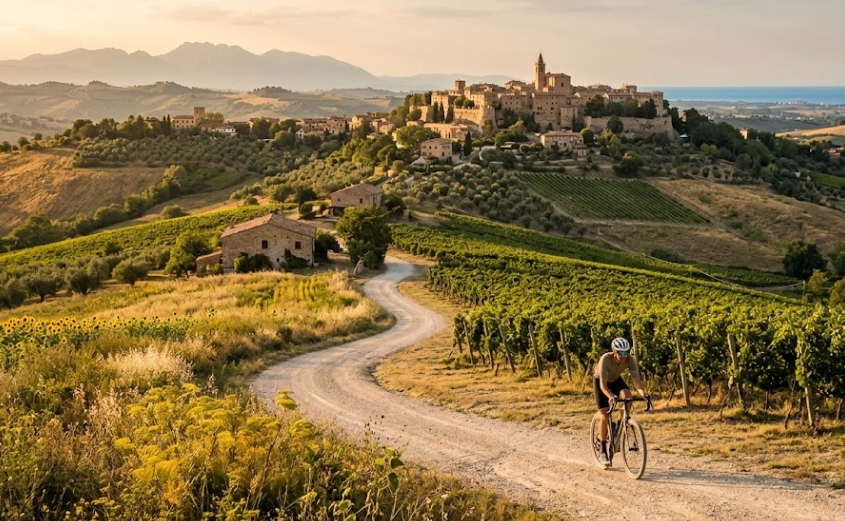
Le Marche’s wine country divides into five territories, each built around its own denomination and its own kind of climb. The Vallesina, north of Ancona, grows Verdicchio dei Castelli di Jesi and Lacrima di Morro d’Alba on rolling terraced hills and is now connected by the Cammino Divino, a brand-new 93-kilometer route linking the coast to the Apennine foothills. The Conero peninsula, a limestone promontory that is the only mountain on the Adriatic coast between Trieste and the Gargano, produces Rosso Conero on short, steep terrain. The Piceno hills around Offida grow Pecorino and Passerina on eroded clay ridges called calanchi. The high valleys around Matelica and Serrapetrona, still visibly rebuilding a decade after the 2016 earthquake, make Verdicchio di Matelica and Italy’s only DOCG sparkling red wine. And the Metauro valley, running inland from Fano toward Urbino, grows Bianchello on gentler terrain beneath a Roman tunnel still open to traffic after nineteen centuries. None of these territories requires more than a rental bike, a train ticket, and a week you weren’t planning to spend in Tuscany.
How the five wine territories compare
| Territory | Principal wine | Terrain | Difficulty | Base town | Best season |
|---|---|---|---|---|---|
| Vallesina | Verdicchio dei Castelli di Jesi, Lacrima di Morro d’Alba | Terraced hills, mixed surface | Moderate | Senigallia or Jesi | April–June, September–October |
| Conero | Rosso Conero DOC / Conero DOCG | Limestone promontory, short steep climbs | Moderate | Numana or Sirolo | May–June, September |
| Piceno / Offida | Offida DOCG (Pecorino, Passerina), Rosso Piceno Superiore | Clay ridges (calanchi), long steady climbs | Easy to moderate | Grottammare or San Benedetto del Tronto | April–June, September–October |
| Matelica / Serrapetrona | Verdicchio di Matelica, Vernaccia di Serrapetrona DOCG | High valley, rolling asphalt roads | Moderate to demanding | Tolentino or San Severino Marche | May–June, September–October |
| Metauro / Colli Pesaresi | Bianchello del Metauro, Colli Pesaresi | River valley, gorge, final climb | Moderate to demanding | Fano | April–June, September |
Each territory below includes one reference route, verified against official regional sources, a local rental or tour operator, and a winery route where a walk-in or reservation policy could be confirmed directly. Where the record is thin — and on a couple of these routes, it genuinely is — I say so rather than fill the gap with something that sounds plausible.
Vallesina: Verdicchio dei Castelli di Jesi and the Cammino Divino
The Vallesina is the valley of the Esino river north of Ancona, and it is where Le Marche’s best-known white wine comes from: Verdicchio dei Castelli di Jesi, grown on terraced hills that a Marchigiano driving past without thinking twice would call ciglioni, the low earthen retaining walls that keep centuries of topsoil from sliding downhill after every hard rain. A smaller, rarer red, Lacrima di Morro d’Alba, grows a few kilometers north around the walled town of Morro d’Alba, made from a grape whose name — “little tear” — refers to how the skin splits and weeps at full ripeness.
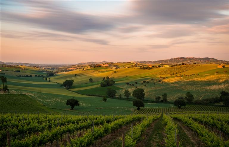
Route: the Cammino Divino
- Distance / elevation gain: 93 km total, bidirectional, divided into four modular stages (Senigallia–Morro d’Alba; Morro d’Alba–San Marcello–Jesi; Jesi–Monte Roberto–San Paolo di Jesi–Staffolo; Staffolo–Cingoli–Apiro). Per-stage distance and elevation figures are not yet standardized in a published GPX; expect roughly a quarter of the total per stage as a rough planning figure.
- Loop or point-to-point: Point-to-point, and explicitly bidirectional — you can start at the coast and climb inland, or start at Apiro and coast down toward Senigallia, returning by regional train along the Adriatic line.
- Bike type: Gravel or trekking bike is the stated design intent; e-bike is explicitly supported for a wider range of riders.
- Difficulty: Moderate. The route was deliberately built on existing secondary roads, paths, and short cycle-path stretches to keep elevation gain progressive rather than sharp.
- Surface: Mixed — secondary roads, farm tracks, and short paved stretches, following the route’s stated principle of using infrastructure that already exists rather than new construction.
- Wineries on route: The route runs directly through the production zones of Lacrima di Morro d’Alba DOC and Verdicchio dei Castelli di Jesi DOC/DOCG, with vineyards and cantine visible from the road at multiple points, particularly through the Monte Roberto–San Paolo di Jesi–Staffolo stage. Because the trail was only formalized in 2026 through a three-year agreement among nine municipalities and the Associazione Cammino Divino APS, not every producer along it yet has a published walk-in policy for cyclists — call ahead rather than assume.
- Where to stop: Jesi is the logical hub of the route, walled, well served, and roughly at the midpoint; Cingoli, voted Italy’s most beautiful village in a 2026 national poll, sits near the final stage and is worth a full stop, not a pass-through. Riders with an extra day can detour from the Apiro end of the route to the Frasassi caves, a short drive or transfer into the neighboring valley.
- Getting there and back: Senigallia and Jesi both sit on the Adriatic and Rome–Ancona rail lines respectively; Marche regional trains marked with the bicycle pictogram carry bikes free of charge, which makes the coast-to-hills, hills-to-coast structure of this route genuinely practical without a support vehicle.
- Best season: Spring or early fall; the route’s bidirectionality means you can chase shade and grade in either direction depending on conditions.
- The engineer’s note: What you are riding across on the Monte Roberto stage is not simply pretty countryside — it is several hundred years of hand-built earthworks. Those low stone-and-earth terrace walls carry real structural load, holding back a hillside’s worth of saturated clay after a wet winter, and where a farmer has let one collapse you can usually trace the slump straight up the slope to a drainage problem nobody fixed in time.
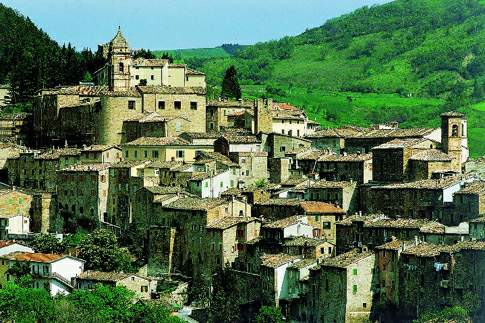
Conero: the shortest, steepest wine territory on the Adriatic
Monte Conero rises 572 meters directly from the sea, the only true mountain on the entire Adriatic coast between Trieste and the Gargano promontory in Puglia, and its slopes produce Rosso Conero DOC and the more concentrated Conero DOCG Riserva, made from Montepulciano grapes at a minimum 85%, occasionally blended with Sangiovese. The production zone covers seven communities — Ancona, Offagna, Camerano, Sirolo, Numana, and parts of Castelfidardo and Osimo — packed into a promontory you can circle by bike in half a day.
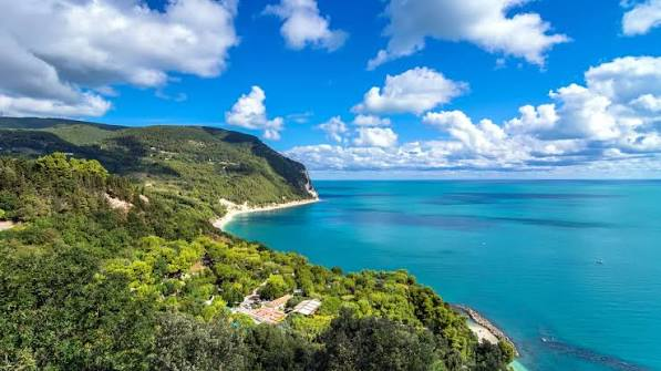
Route: Numana–Sirolo–Coppo–Camerano loop
- Distance / elevation gain: 25 km, 400 m elevation gain.
- Loop or point-to-point: Loop, starting and finishing at Marcelli di Numana.
- Bike type: E-bike, supplied as part of the guided tour.
- Difficulty: Moderate — the climb out of Numana toward Sirolo is short but genuinely steep, which is exactly why the e-bike option exists for this territory rather than being a gimmick.
- Surface: Mixed paved road and white gravel roads through the vineyard sections between Sirolo, Coppo, and Camerano.
- Wineries on route: The guided route stops at one of three local wineries or farms depending on availability, for a tasting of Rosso Conero paired with regional products; specific producer names rotate, so confirm at booking rather than counting on a named cantina in advance.
- Where to stop: The route departs from Conero by Bike’s own base at Via Litoranea 8 in Marcelli di Numana, which also functions as a rest and water stop before and after.
- Getting there and back: No coastal town on the Conero peninsula sits directly on the Adriatic rail line; most riders arrive by car or transfer and rent locally at the coast rather than combining this route with a train leg.
- Best season: June through October, which is the operator’s stated guided season.
- The engineer’s note: The reason this coastline looks nothing like the sandy Adriatic to its north and south is geology, not decoration. Monte Conero is limestone — Calcare Massiccio — sitting on top of younger clays, and where the two meet you get exactly the kind of unstable slope that makes an engineer slow down and look twice at any retaining wall built into the hillside above a coastal road.
For a self-guided version, Conero by Bike also publishes a 174-kilometer road/e-bike loop through fifteen inland towns including Loreto and Recanati — rated Hard, and better suited to a strong rider with a full day than to the reference route above.
Piceno and Offida: Pecorino, Passerina, and the calanchi roads
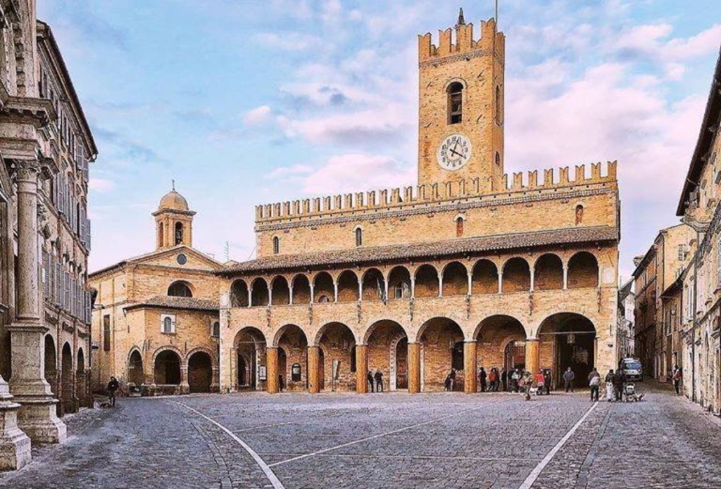
The Piceno hills sit inland from the Riviera delle Palme — the stretch of coast running from Grottammare to San Benedetto del Tronto — and rise toward Offida and Ripatransone across a landscape locals call the calanchi: bare, ribbed clay ridges, eroded into folds by rain, that look almost lunar against the surrounding vineyards. This is Offida DOCG territory, producing Pecorino and Passerina, two white grape varieties that were nearly extinct by the 1970s before local growers, including the Cocci Grifoni family, deliberately replanted them starting in the 1980s.
Route: Grottammare–Offida
- Distance / elevation gain: 23 km, 370 m elevation gain, rated Easy by the Marche regional tourism board’s official cycling registry.
- Loop or point-to-point: Point-to-point; the return either retraces the route or continues on to Ripatransone for a longer day.
- Bike type: Road, gravel, or e-bike; charging points are available at the top for e-bike riders.
- Difficulty: Easy, per the official regional classification, though the first climb out of Grottammare is described locally as the steepest stretch of the day.
- Surface: Mostly paved secondary roads, with a short unpaved section roughly five kilometers in.
- Wineries on route: Cantina dei Colli Ripani, a cooperative winery in Ripatransone, runs reservation-based tastings from €15 to €20 per person depending on the flight; Ciù Ciù Tenimenti Bartolomei, based in Offida, runs a similar reservation-only tasting menu pairing Offida DOCG wines with regional cured meats, cheese, and two traditional dishes. Neither accepts unannounced walk-ins.
- Where to stop: Offida’s historic center, built around the Piazzale delle Merlettaie — named for the town’s tradition of tombolo bobbin lace, still practiced by local women — is worth a slow hour, not a photo stop.
- Getting there and back: Grottammare and San Benedetto del Tronto both sit on the Adriatic rail line with regional trains carrying bikes free; Offida itself has no station, so plan the return by bike or arrange ground transport.
- Best season: April through June or September through October; midsummer exposes long stretches with little shade.
- The engineer’s note: Those calanchi ridges are not a stable formation. They are clay and marl, largely impermeable, eroding fastest exactly where vegetation has been cleared for cultivation — which means the same slopes that produce Offida’s wine are also the ones most prone to the kind of shallow landslip that closes a rural road for a season. Locals read a fresh crack across a field the way you’d read a check-engine light.
For a longer, harder day, the official San Benedetto del Tronto–Ripatransone route climbs 500 meters over 40 fully paved kilometers, rated at the top of the regional difficulty scale for road cycling, reaching Ripatransone’s historic center — home, according to local claim, to Italy’s narrowest alley — before descending back to the coast through Valtesino. Riders with a full extra day sometimes push further inland to Ascoli Piceno itself, though that adds real distance and climbing rather than a casual add-on.
Matelica and Serrapetrona: Verdicchio, Vernaccia, and a decade of rebuilding
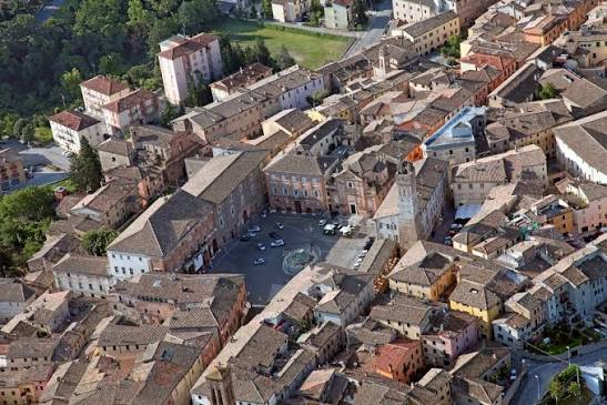
This territory sits apart from the other four, geographically and emotionally. Matelica and Serrapetrona lie in the high valleys of the Esino and Chienti rivers, inland toward the Apennines and within sight of the Sibillini range on a clear day, and both were inside the crater of the 2016 central Italy earthquake sequence. Matelica produces its own Verdicchio, distinct from the Castelli di Jesi version and often structurally bigger; Serrapetrona is the exclusive home of Vernaccia di Serrapetrona DOCG, made from the Vernaccia Nera grape and fermented three separate times — the only sparkling red wine in Italy to hold DOCG status.
Route: Colli della Vernaccia
- Distance / elevation gain: 45 km, 650 m elevation gain, min. altitude 200 m, max. altitude 525 m, per the official Marche regional cycling registry.
- Loop or point-to-point: Loop, starting and finishing at Tolentino.
- Bike type: Road bike; the route is 100% paved.
- Difficulty: Rated “good technical ability required” by the regional registry — moderate to demanding, with sustained rolling terrain rather than one defining climb.
- Surface: Fully paved.
- Wineries on route: Serrapetrona’s producers open their doors together every November for Appassimenti Aperti, a free, no-reservation two-Sunday festival where wineries including Colleluce, Fontezoppa, and Terre di Serrapetrona show visitors the appassimento rooms where grapes dry before the final fermentation. Outside that festival window, small producers here generally require a phone call ahead rather than offering standing tasting hours.
- Where to stop: Tolentino’s Ponte del Diavolo and the Basilica di San Nicola anchor the start and finish; Serrapetrona itself, roughly at the route’s midpoint, is the place to get off the bike for an hour.
- Getting there and back: Tolentino sits on an inland rail line; check current regional timetables, since inland Marche service is sparser than the Adriatic coast.
- Best season: May through June or September through October. If timing allows, the second and third weekends of November bring Appassimenti Aperti, though by then the riding season is effectively over for anyone without proper winter kit.
- The engineer’s note. Serrapetrona’s reconstruction stood at roughly 43 percent complete as of mid-2026, ten years after the earthquake; neighboring Matelica was at about 41 percent, and San Severino Marche — one of the hardest-hit towns in absolute terms, with 1,924 buildings originally declared unfit for use — was at just over 42 percent, with roughly 800 formal repair decrees issued. Camerino, the symbolic center of the Marche crater, sat lower still, at roughly 36 percent, though its historic core finally began hearing construction cranes again in 2025 after years of silence. In thirty years surveying buildings across this province, I have climbed onto more scaffolding platforms than I can count, and what strikes me riding through towns like these isn’t the damage — that part is finished, mostly cleared away — it’s the specific, unglamorous slowness of putting a load-bearing wall back exactly the way it has to go, decree by decree, euro by euro. A cyclist stopping for lunch or a bottle of Vernaccia in Serrapetrona or Caldarola is not intruding on a disaster site. Every euro spent there is going somewhere that has spent a decade waiting for it.
Metauro Valley and Colli Pesaresi: Bianchello, Roman roads, and an honest gap
The fifth territory runs from Fano on the coast up the Metauro valley toward Urbino, through Bianchello del Metauro and Colli Pesaresi DOC country. It is also the territory where I have to be straightforward about the state of the infrastructure, because a regional tourism board press release and the reality on the ground currently disagree.
A dedicated cycle path — the Ciclovia del Metauro — has been planned for years to follow the disused Fano–Urbino railway line, closed in 1987 and officially decommissioned in 2011. As of mid-2026, construction is real but limited to the Fano urban stretch: crews have completed a steel bridge over the Fano–Grosseto expressway and are finishing a second crossing over the Albani canal, part of a roughly seven-million-euro first phase that reaches only as far as Cuccurano, still within Fano’s town limits. The old railway trackbed beyond that point remains what a local advocacy group bluntly calls “a stretch of brambles,” not a rideable path. If a website or a rental shop tells you there’s now a dedicated bike path all the way to Urbino, that information is out of date.
Route: Fano to Urbino via the Gola del Furlo (assembled from verified segments)
- Distance / elevation gain: Approximately 55–60 km one-way, assembled from ordinary secondary roads rather than a single official GPX; exact figures will vary by the specific roads chosen through Fossombrone.
- Loop or point-to-point: Point-to-point. Urbino has no train station of its own — a genuine local quirk, not an oversight in this guide — so plan a bus transfer or an arranged pickup for the return, or ride back the way you came.
- Bike type: Road or gravel.
- Difficulty: Moderate to demanding. Riders report the direct climb out of Fossombrone hitting 16 to 18 percent in sections; starting the climb a few kilometers past Fossombrone, rather than in the town center, avoids the worst of it.
- Surface: Paved secondary roads for most of the route, with a protected, curb-separated bike lane through the Gola del Furlo itself, in place since at least 2023.
- Wineries on route: This is the one territory in this guide where I could not verify a specific winery’s public tasting hours or reservation policy through primary sources. Bianchello del Metauro and Colli Pesaresi producers exist along this valley, but the wine-tourism infrastructure here is visibly less developed than in the other four territories — treat any winery stop as a phone call in advance, not a plan.
- Where to stop: Fossombrone, roughly a third of the way in; the Gola del Furlo itself, where the Antico Furlo bar-restaurant sits just before the Roman tunnel; and Acqualagna, Italy’s white-truffle town, near the route’s inland turn toward Urbino.
- Getting there and back: Fano sits directly on the Adriatic rail line with free bike transport on regional trains; there is no equivalent rail option at the Urbino end.
- Best season: April through June or September, avoiding both summer heat in the exposed gorge sections and the steepest winter road conditions around Urbino.
- The engineer’s note: The tunnel through the narrowest point of the gorge was cut through solid limestone under the emperor Vespasian in the first century AD, to ease a stretch of the Via Flaminia so tight the Romans called it Petra Pertusa — the pierced rock. It is still standing, still carrying traffic, without a single modern reinforcement, nineteen centuries later. Ride through it once and you’ll understand why the modern cycle path a few kilometers downstream, stalled for years over budget and land disputes, feels like the newer and more fragile piece of infrastructure by comparison.
Getting set up: rentals, trains, and timing
Bike rental in Le Marche is genuinely regional rather than centralized around one hub. Conero by Bike, based in Marcelli di Numana, is the most complete operation among the five territories covered here, running both guided tours and self-guided routes with road, gravel, and e-bike rentals, and staff who speak English, French, and Spanish alongside Italian. Outside the Conero territory, expect smaller, town-based rental shops rather than a single regional chain; asking at your accommodation or the local tourist office (ufficio turistico) usually turns up an option faster than searching online, since many of these operators don’t maintain much of a web presence.
Trains are more standardized than rentals, and more useful than most American cyclists expect. Marche regional trains marked with the bicycle pictogram carry bikes entirely free of charge — you simply show the bike to the conductor before boarding to receive the complimentary supplement, no advance booking required. This makes point-to-point routes genuinely practical: ride inland from the coast, then take the train back to your starting town, rather than retracing every kilometer. The Adriatic line serves the coastal starting points for the Vallesina, Piceno, and Metauro territories directly; inland service to towns like Tolentino exists but runs less frequently, so check current timetables before building a day around a specific connection.
On timing: April through June and September through October are the sweet spot across all five territories, avoiding both summer heat on exposed climbs and the vendemmia — grape harvest, typically running from early September into October depending on the territory and variety — when narrow rural roads carry more tractor and truck traffic than usual. None of that traffic is dangerous if you’re expecting it; it becomes a problem only for a rider who assumed a quiet farm road would stay quiet in the last week of September.
The single most common mistake isn’t the wine or the weather — it’s the elevation profile. A 23-kilometer route with 370 meters of gain, or a 45-kilometer loop with 650 meters, reads as gentle on a map next to the Dolomites, but Le Marche’s hills are short, frequent, and rarely flat for more than a kilometer at a stretch; riders coming from flatter home terrain consistently underestimate how much climbing adds up over a day here. Book winery stops in advance wherever this guide notes a reservation-only policy, and carry more water than the distance alone suggests you’ll need.
If you’re mapping out where a survey or renovation project might fit into a longer stay in Le Marche — particularly around Matelica, Serrapetrona, or the wider seismic-affected zone — the property survey guide for foreign buyers covers what an independent pre-purchase technical assessment actually involves.
The takeaway
Five wine territories, one region, and — outside the Conero peninsula — almost none of the polished, English-language cycling infrastructure that Tuscany or the Prosecco Hills have built up over twenty years of tourism marketing. That is not a flaw in the plan. It is the reason a rider who shows up here in 2026 will have Cammino Divino stretches, Piceno calanchi roads, and Serrapetrona’s appassimento rooms essentially to themselves, at exactly the moment these territories are starting to organize themselves for exactly this kind of visitor.
If you’re planning a longer stay in Le Marche and want an Italian insider’s read on where to base yourself, I offer a 30-minute planning consultation — you can book a slot here.
—
FAQ — Cycling Le Marche’s wine country
What makes Le Marche different from Tuscany or the Prosecco Hills for wine cycling? Le Marche has five distinct wine denominations packed into a small area between the Adriatic and the Apennines, almost none of it built out for English-language cycling tourism yet. Expect real working vineyards and small, appointment-only producers rather than the polished tasting-room circuit of more established Italian wine-cycling regions.
When is the best time to cycle Le Marche’s wine regions? April through June and September through October, avoiding both summer heat on exposed climbs and the vendemmia grape harvest in September, when narrow rural roads see more tractor traffic than usual.
Do I need to book winery visits in advance? Yes, in almost every case. Producers named in this guide — Cantina dei Colli Ripani, Ciù Ciù Tenimenti, and the Serrapetrona wineries outside the November Appassimenti Aperti festival — all operate on reservation, not walk-in.
How much does it cost to rent a bike or join a guided tour? A guided e-bike tour with wine tasting on the Conero peninsula runs around €60 per person for up to four hours, including bike, helmet, insurance, and guide. Independent rentals elsewhere in the region vary by town and are usually arranged locally rather than online.
How many days do I need to cover all five territories? A full loop touching all five comfortably takes seven to ten days including rest and tasting time, or five days if you skip one territory and ride point-to-point using regional trains between bases.
Can I combine this with the Cammino Divino as a multi-day trip? Yes — the Cammino Divino’s Vallesina stages overlap directly with the wine-cycling territory described here, and its bidirectional design means you can ride it as either the opening or closing leg of a longer regional trip.
What should I know about cycling through the earthquake reconstruction zone around Matelica and Serrapetrona? The towns are safe to visit and actively want cyclists and other travelers; reconstruction was roughly 40 to 45 percent complete as of mid-2026 depending on the town, with active construction sites visible in several historic centers. Expect scaffolding and some closed streets, not devastation — and know that money spent in a café or winery there is going into communities that have waited a decade for exactly that kind of return.
—
Written by Mirco Vitellozzi, a structural engineer from Le Marche who writes about Italy from the inside. More essays at Tastes & Wonders of Italy, and short films on YouTube.