The Cammino Divino: Marche’s New 93-Km Wine Cycling Route
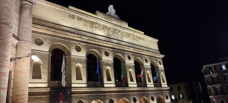
At six in the morning the Adriatic outside Senigallia is still the color of pewter, and the arcades of Portici Ercolani stand empty except for a baker propping open his shutters. This is where the Cammino Divino starts, or ends, depending on which direction you’re pointed: a 93-kilometer route, formalized in February 2026, that climbs out of the beach town I’ve watched fill and empty with tourists for three decades and disappears into a landscape almost nobody outside Le Marche has heard of. It runs through the Vallesina, the valley of the Esino river, where two wines I grew up hearing named at family tables — Lacrima di Morro d’Alba and Verdicchio dei Castelli di Jesi — are grown on hills that have never needed to perform for anyone. I have driven every one of these roads more times than I can count, mostly for work, assessing farmhouses and church bell towers for people who live an ocean away from them. I know what a genuinely new piece of regional infrastructure looks like before the marketing catches up to it. This is one.
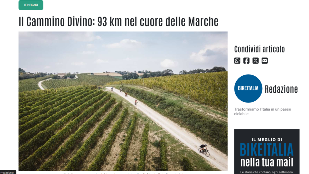
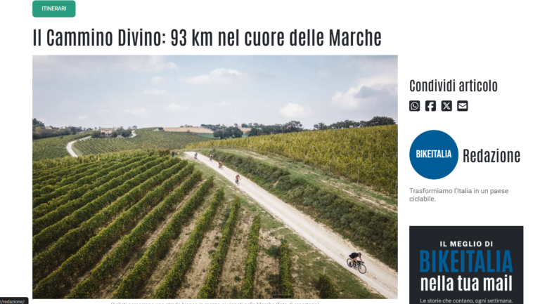
The Cammino Divino is a 93-kilometer, bidirectional cycling and walking route connecting the Adriatic coast at Senigallia to the inland town of Apiro, at the foot of Monte San Vicino in Le Marche, central Italy. Nine municipalities — Senigallia, Morro d’Alba, San Marcello, Jesi, Monte Roberto, San Paolo di Jesi, Staffolo, Cingoli, and Apiro — signed a formal three-year protocol with the promoting Associazione Cammino Divino APS in February 2026 to manage, maintain, and promote the route jointly. It runs through the wine country of the Lacrima di Morro d’Alba DOC and the Verdicchio dei Castelli di Jesi DOC, following existing secondary roads, farm tracks, and trails rather than a purpose-built bike path. It suits gravel bikes and trekking bikes best, is manageable on an e-bike, and can be ridden in either direction — coast to mountains, or mountains to coast.
What “new” actually means here
Here is what an American reading a press release about a brand-new 93-kilometer route might picture: a ribbon of fresh gravel or asphalt, signed at every junction, with a downloadable GPX file and a polished interactive map. That is not quite what exists yet, and I would rather tell you now than have you find out on a July afternoon with a dead phone battery and no idea which fork in the road to take.
What the nine municipalities and the Associazione Cammino Divino APS actually signed in February 2026 is a protocollo d’intesa — a formal cooperation agreement, not a construction contract. The route itself is not new pavement. It is a curated sequence of roads and paths that already existed, stitched into a single named, bidirectional itinerary: low-traffic secondary roads, farm and forestry trails, and short stretches of existing bike paths. Municipal documentation behind Jesi’s approval of the agreement describes what the route still needs as routine maintenance and the installation of dedicated signage — nothing more structural than that. In plain terms: the roads exist, the wine country exists, the villages exist. The signs mostly do not, not yet.
I read a fair amount of public works paperwork in my other line of work, and I recognize this kind of language. It is careful, honest municipal Italian for “we are formalizing something that has worked informally for years, and we will mark it properly over time.” That is a reasonable, even admirable way to build a rural route — cheaper, faster, and gentler on the landscape than bulldozing a dedicated corridor. But it also means that if you ride the Cammino Divino in its first season, you are riding largely on local knowledge and a paper map, not on a fully signed, GPS-verified trail. As of this writing, I could not locate a published GPX track or a dedicated public website for the Associazione Cammino Divino APS; the route’s online footprint, months after the protocol was signed, is still mostly regional press coverage rather than trip-planning tools. I’ll also flag something an engineer notices and a travel writer might not: several of the news reports covering the signing describe it as an agreement among “ten municipalities,” though the signatories actually named are nine towns plus the promoting association. It’s a small imprecision, but it’s the kind of detail that tells you this is a project still being written about faster than it’s being documented.
None of this makes the Cammino Divino a bad idea, or not worth riding — quite the opposite. It makes it an early adopter’s route, better suited to someone who already rides gravel with a paper map and a general sense of direction than to someone who wants turn-by-turn navigation and a coffee shop every fifteen kilometers. If that description fits you, this is one of the more interesting new rides in central Italy this year, precisely because almost nobody has written about it in English yet.
The coastal-to-Jesi arc: two stages through Lacrima country
Regional coverage of the protocol breaks the full 93 kilometers into four working segments. For a visitor planning two or three days in the saddle, it makes more sense to think in two acts: the ride from the sea to Jesi, largely Lacrima territory, and the climb from Jesi into the Verdicchio hills and the Apennine foothills, covered in the next section.
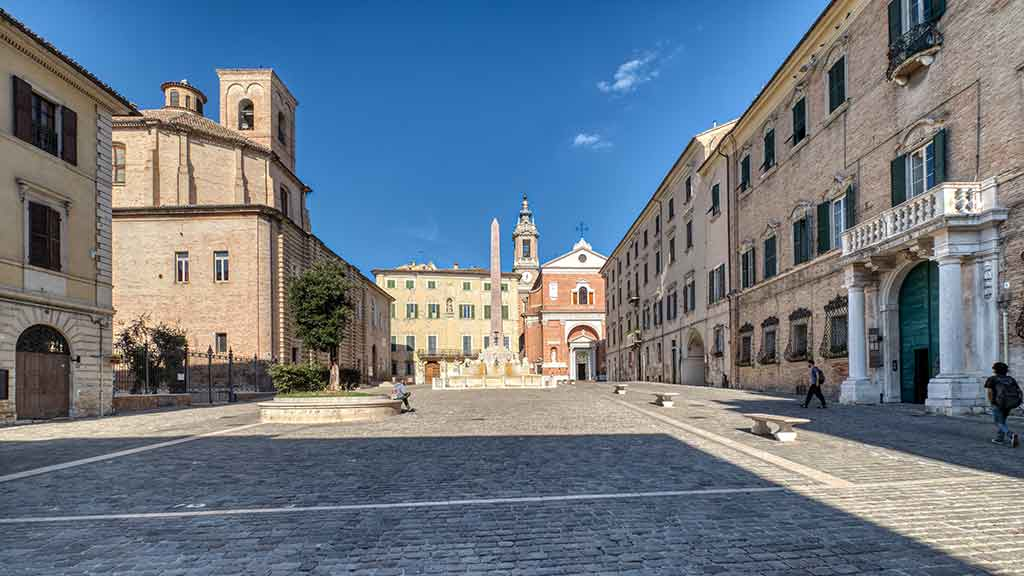
Stage 1 — Senigallia to Morro d’Alba
Terrain. The road leaves Senigallia’s flat coastal strip almost immediately and starts rolling — short climbs and drops through farmland, the first sign you’ve left the beach behind.
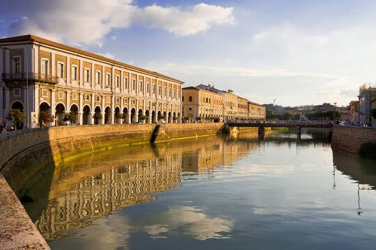
Surface. A mix of paved secondary roads and unpaved farm tracks, per regional coverage of the route; no official stage-by-stage surface breakdown has been published.
Wine. This is the entry point into Lacrima di Morro d’Alba DOC country, a red grape variety that exists, as a serious commercial matter, almost nowhere outside a few kilometers around the town of Morro d’Alba itself.
Food and lodging. Morro d’Alba’s compact historic center, built around its unusual covered walkway known as La Scarpa (literally “the shoe,” for the shape it traces around the walls), has agriturismi and small wineries within walking distance of the gate.
Distance and elevation. Not yet published as a per-stage figure by the organizers. Expect this to be the shortest and gentlest of the four segments.
Stage 2 — Morro d’Alba to San Marcello to Jesi
Terrain. The route drops into the Esino valley proper, running through the small comune of San Marcello before climbing gently into Jesi, the largest town on the entire Cammino Divino.
Surface. Vallesina back roads and vineyard tracks, with stretches of urban and peri-urban cycling infrastructure on the approach to Jesi.
Wine. You cross here from Lacrima territory to the edge of Verdicchio dei Castelli di Jesi DOC, though the classic hillside vineyards are still ahead in the next stretch.
Food and lodging. Jesi is the logical overnight stop for most riders: a walled medieval center, real hotel and B&B capacity, restaurants that don’t shut for the entire afternoon the way the smaller villages do, and a train station that puts the whole coastal half of the route within easy reach if your plans change.
Distance and elevation. Also not published stage by stage. This segment covers more flat valley floor than the first, with the climbing concentrated in the final approach into Jesi.
From Jesi to Apiro: where the Cammino Divino stops being easy
Past Jesi, the character of the ride changes, and it’s worth being direct about that before you commit to riding all 93 kilometers in one trip.
The route climbs from Jesi through Monte Roberto and San Paolo di Jesi toward Staffolo, a hill town that sits inside what growers here simply call the golden triangle of Verdicchio dei Castelli di Jesi DOC, alongside Cupramontana and Maiolati Spontini — though neither of those two is a formal stop on the Cammino Divino itself. This is the stretch where the wine becomes the landscape rather than a subject you visit: rows of vines run along nearly every hillside, interrupted by small cantine (wine cellars), some open only by appointment.
From Staffolo, the route continues to Cingoli — already the most documented stop on the Cammino Divino for English-language readers, since I’ve written separately about the hill town Italians themselves voted their most beautiful village. Cingoli sits above 600 meters, with a panorama over Lake Cingoli and, on a clear day, the Adriatic itself, which makes it a natural resting point regardless of which direction you’re riding.
The final stretch, from Cingoli to Apiro, is the most Appenninic section of the whole route: wider views, thinner traffic, and a landscape that starts looking toward the mountains rather than the sea. Apiro itself sits at the foot of Monte San Vicino, a market town of roughly two thousand people, and functions as the symbolic hinge point of the entire project — the place where the coast finally gives way to the mountains.
I want to be straightforward about the difficulty here, because no one else covering this route in English is likely to be. This is not a flat wine tour. The elevation gain from Senigallia to Apiro is real and, based on the terrain itself rather than any published elevation profile — none has been released as of this writing — cumulative rather than occasional: rolling hills stacked on rolling hills, with the steepest sustained climbing concentrated in this final push toward Cingoli and Apiro. A gravel bike or trekking bike handles it comfortably. A road bike with narrow tires will struggle on the unpaved sections. An e-bike, as the route’s own promoters have pointed out, meaningfully widens who can realistically take this on.
Two DOC wines as a way of reading the Vallesina
Most articles about a wine road treat the wine as a checklist item: name, grape, a tasting note borrowed from somewhere else. On the Cammino Divino, the wine is closer to a key for reading the land itself, and it’s worth understanding both before you clip in.
Lacrima di Morro d’Alba DOC is the odd one out among Marche reds: a deeply aromatic, floral variety — violets and dark cherry are the notes growers reach for — that all but disappeared through the twentieth century and survived almost entirely around Morro d’Alba because a handful of families refused to pull up the vines. It is not built for long aging or heavy tannins. It’s built for the table, served slightly cool, alongside exactly the kind of salumi and fresh pasta you’ll find in the agriturismi along Stage 1. Riding through this territory, you notice how small the production zone actually is — Lacrima isn’t diluted across the region the way some DOCs are; it’s concentrated in a tight ring around one town, which is precisely why the Cammino Divino’s route through here matters to producers who have almost no other channel for direct visitor contact.
Verdicchio dei Castelli di Jesi DOC is the better-known of the two internationally, and rightly so: a structured, mineral white with real aging potential, at its most serious in the Riserva bottlings that qualify for the separate Castelli di Jesi Verdicchio Riserva DOCG designation. The golden triangle around Staffolo, Cupramontana, and Maiolati Spontini is where the variety reaches its most concentrated expression, on limestone-rich hillsides that the Cammino Divino’s inland stages cut directly through. I have eaten this wine’s natural pairing more times than I could count — brodetto, the Adriatic fish stew that varies by town along this same coast — at tables belonging to people who grow the grapes themselves, and the contrast between the two wines is really a contrast between the two halves of the route: Lacrima is the coast’s memory of the hills, and Verdicchio is the hills’ own voice.
Riding it: when to go, how to get there, and what to bring
When to go. Late spring (May into early June) and early autumn (September into mid-October) are the honest answers, and for the same reason that applies to most of inland Le Marche: summer heat sits heavily in the Vallesina by midday, and the climbing sections toward Cingoli and Apiro are unpleasant work in full August sun. Early October has the added advantage of the vendemmia — the grape harvest — still active or just finished around Staffolo and Cupramontana, when cantine are busiest and most interesting to visit, though also least likely to have spare time for a drop-in tasting without notice.
Getting there by train. Senigallia sits on the Adriatic rail line linking Bologna, Ancona, and points south, with frequent regional service. Jesi sits on the line connecting Ancona to Rome via Falconara Marittima, which makes a coast-to-Jesi or Jesi-to-coast one-way ride entirely practical logistically — you can ride one direction and take the train back. One detail worth knowing before you plan around it: bicycle transport on regional trains within Le Marche is free of charge, with a complimentary supplement issued on board by train staff on services marked with the bicycle pictogram. That is a genuinely useful, region-specific fact that doesn’t apply everywhere in Italy, where regional trains elsewhere often charge a small supplement for a mounted bike.
Rental and support. I’m not going to hand you a list of specific prices, since they change and I haven’t verified any this season, but the operators exist. Jesi Bike Tours runs guided road, gravel, and e-bike outings across the Vallesina and can be a sensible option for a first pass at this route rather than navigating it solo. Centro Bici Senigallia, in the historic center near the coastal starting point, handles rental and repair. Toward the inland end, the tourism office in Cupramontana — self-styled capital of Verdicchio, adjacent to the Staffolo stretch — offers e-bike rental aimed specifically at visitors doing exactly this kind of hill-country riding.
What to bring, and what to skip. Bring a paper map or an offline GPS track you’ve built yourself, since neither an official app nor a downloadable GPX file was available as of this writing. Bring more water than you think you need for the inland stages; villages here don’t have the tourist-town density of fountains and cafés you’d find in Tuscany. Skip the narrow-tire road bike unless you’re comfortable walking short unpaved sections, and skip the idea of doing all 93 kilometers as a single push unless you’re already fit for multi-day touring — splitting it across Senigallia to Jesi one day and Jesi to Apiro the next is the more realistic plan for most visitors.
If you’d rather do a guided version of this territory before the Cammino Divino is fully signed and mapped, a small-group Verdicchio and Lacrima wine tour through the same hills is a reasonable substitute for the wine-tasting half of the experience, without the navigation risk.
FAQ — Riding the Cammino Divino
What is the Cammino Divino?
It’s a 93-kilometer, bidirectional cycling and walking route in Le Marche, connecting the Adriatic coast at Senigallia to the inland town of Apiro. Nine municipalities and the Associazione Cammino Divino APS formalized it with a joint protocol in February 2026.
When is the best time to ride the Cammino Divino?
Late spring and early autumn. Summer heat makes the inland climbing sections toward Cingoli and Apiro uncomfortable, while early October coincides with the grape harvest around the Verdicchio hills.
Do I need to book anything in advance?
Not to ride the route itself, since it’s on public roads and trails. You should book ahead for cantina visits, especially around Staffolo and Cupramontana, and for accommodation in smaller villages, where options are limited.
Is the route signposted?
Not fully, as of this writing. The February 2026 protocol commits the municipalities to install dedicated signage over time; for now, riders should carry a paper map or their own offline GPS track rather than rely on trail markers.
How many days does it take?
Most visitors will want two to three days. A practical split is Senigallia to Jesi on day one and Jesi to Apiro on day two, with a possible third day added for wine visits around Staffolo and Cupramontana.
What kind of bike do I need?
A gravel bike or trekking bike is the best match for the mixed paved and unpaved surfaces. An e-bike is a reasonable choice for the climbing in the second half. A road bike with narrow tires will struggle on the unpaved sections.
Can I ride just part of it, or combine it with somewhere else in the Marche?
Yes. The route is bidirectional and passes through Jesi, which has train connections, making a partial ride practical. It also connects naturally to nearby Le Marche destinations already covered on this blog, including Cingoli and the wider Le Marche region.
The final word
The Cammino Divino is not, today, a finished product. It’s a formal agreement, a genuinely good route on the ground, and a fair amount of signage still to come. I’d rather send you into it with that understanding than let a press release do the talking, because the honest version is still a good trip: 93 kilometers of coast, wine country, and Apennine foothills that almost no English-language traveler has ridden yet, through two DOC zones that most visitors to Italy never taste outside a wine bar back home.
If you want more dispatches like this from an Italian engineer’s perspective on the region I actually live and work in, subscribe to the Tastes & Wonders of Italy newsletter — it’s where I flag exactly this kind of thing before it’s fully on anyone else’s radar.