Cycling the Metauro Valley: Roman Tunnels to Urbino
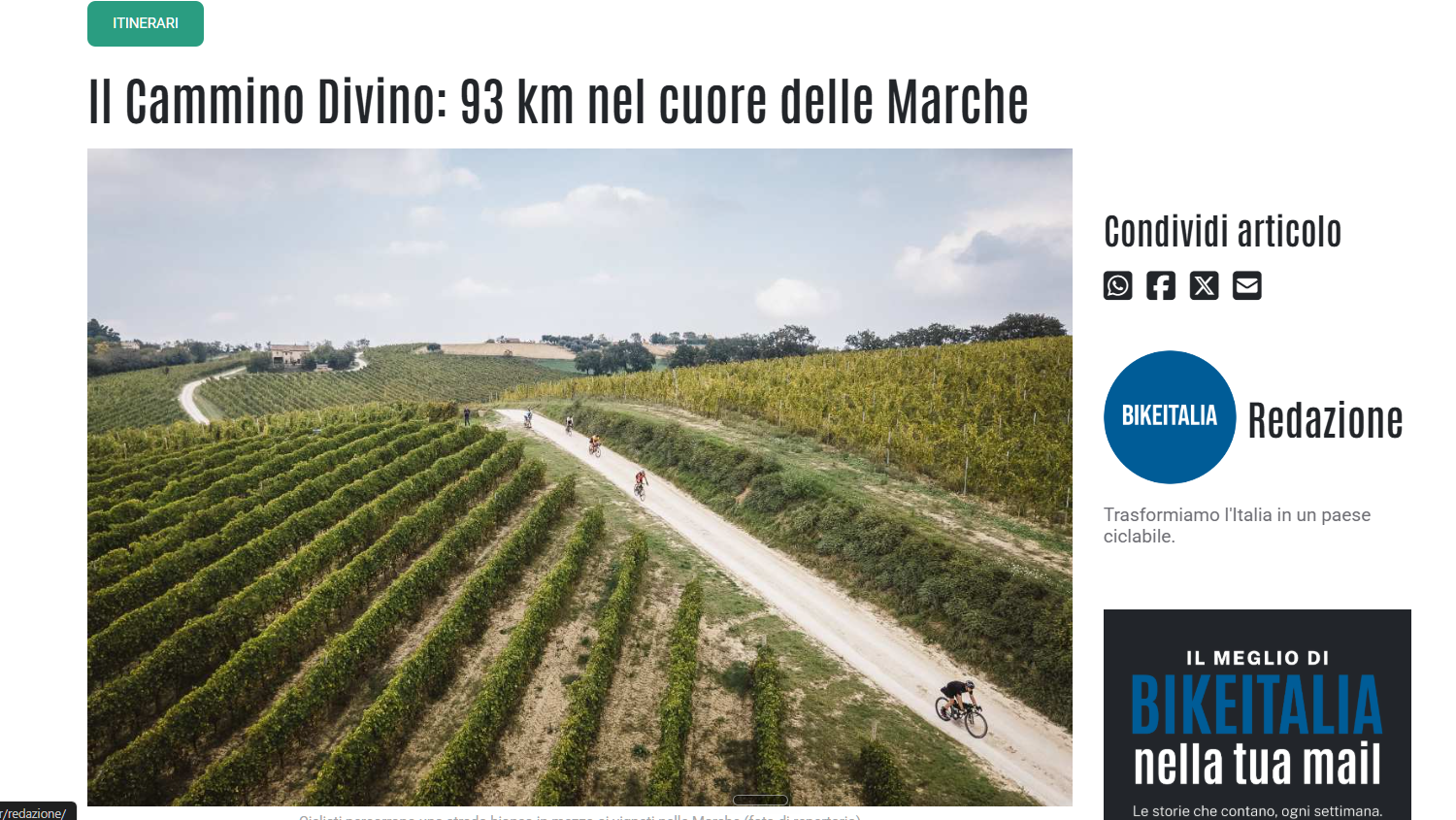
Fano at six in the morning smells like salt and diesel from the fishing boats idling out of the canal, and if you are cycling the Metauro Valley toward Urbino, this is where the ride actually begins: not at a trailhead, but under a stone archway that has marked the end of the Via Flaminia since the year 9 AD. This inland route follows the Metauro River roughly 55 to 60 kilometers from the Adriatic coast to the hilltop city of the Montefeltro dukes, climbing through two wine denominations, one DOP olive oil zone, and a limestone gorge that Roman engineers physically cut open. You will not find a single official GPX file for the whole thing — the route is stitched together from ordinary secondary roads — but every section of it has been ridden, mapped, and argued over by enough local cyclists to trust.
Why this valley, and not the coast
Most visitors who fly into Bologna or Ancona see the Adriatic first: the flat, crowded ribbon of beach towns between Rimini and Ancona. The Metauro does something different. It runs inland and slightly uphill, away from the umbrellas, along a river valley the Romans considered important enough to fortify, garrison, and eventually name a city after. Fano’s Roman name was Fanum Fortunae, “the shrine of Fortune,” and the most credited explanation for that name is a temple built to commemorate a battle fought a few kilometers up this very river: the Battle of the Metauro, 207 BC, in which the consuls Gaius Claudius Nero and Marcus Livius Salinator destroyed the army of Hasdrubal Barca before he could join forces with his brother Hannibal. The nineteenth-century historian Edward Creasy ranked it among history’s fifteen decisive battles, on the reasoning that a Carthaginian victory here might have changed who controlled the Mediterranean world.
Where exactly it happened is a question modern archaeology has not settled. Weapons fragments and Roman military equipment have turned up in the upper valley, and several researchers place the likely site near Fossombrone, but no battlefield has been definitively excavated. I mention this because it is tempting, writing about a river with this kind of résumé, to plant a flag and call a hillside “the battlefield.” An honest guide does not do that. What is certain is the road: Nero marched his troops up this valley by forced night march to reach Livius before Hasdrubal knew the two consular armies had combined, and the road he used is, in its broad strokes, the one you are about to ride.
The arch itself is worth a slow look before you clip in. Built in travertine with a large central passage for carts and horses flanked by two smaller pedestrian openings, it once carried an upper story of seven arched windows, destroyed in 1463 during the siege that handed the city to Federico da Montefeltro — the same duke whose palace waits for you at the far end of this ride.
Cartoceto: the climb nobody puts on the map
Nine kilometers out of Fano, most route descriptions send you straight along the valley floor. I would not. A short detour south into the hills, up toward Cartoceto, costs you a genuine climb and rewards it with the only DOP-certified olive oil territory in the entire Marche region — a fact regional tourism material likes to soften into “one of the best,” when the disciplinare simply makes it the only one. The zone, recognized in 2004, covers Cartoceto itself and a handful of neighboring hill communities along the river’s north bank, and it has been producing olive oil since at least 1178, according to the earliest surviving documents.
The blend leans on three cultivars — Raggiola, Frantoio, and Leccino — and what distinguishes it from the more famous Tuscan oils is restraint: less bitterness, less of the throat-catching pepper finish, more of a soft, almond-toned roundness that pairs badly with the assumption that “peppery” is a quality marker rather than a style choice. If you time the ride for early November, the town runs an olive oil festival that has been going since the 1970s; any other season, look for a producer willing to do a walk-in tasting rather than counting on it.
Fossombrone: the Roman colony you pass through, not to
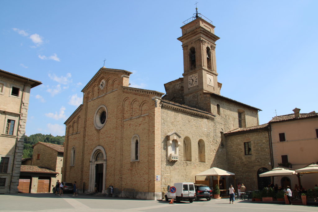
Back down on the valley floor, the road runs through Fossombrone, ancient Forum Sempronii, a Roman market town that later became the medieval seat of the Malatesta and then the Montefeltro. Most cyclists treat it as a water-and-espresso stop before the real climbing starts, which undersells it slightly — this is also, roughly, where the road toward the Furlo gorge splits from the flatter route toward Urbania — but the town earns a longer look if you have the legs and time for it later.
Locals call Fossombrone the town of the Three Courts. Federico da Montefeltro built the first, the Corte Alta, starting in 1464 as a secondary residence on the hillside above town, with work attributed in part to the same architect, Francesco di Giorgio Martini, who later shaped Urbino’s own ducal palace. His son Guidobaldo I preferred the town enough to build a second, more intimate residence down on the valley floor, the Corte Bassa, and died in Fossombrone in 1508. The Corte Alta now houses the town’s archaeological museum and civic art gallery, and it is the closest thing on this route to a preview of what waits for you at the top of tomorrow’s climb.
It is also, coincidentally, close to where a second and much later battle was fought over the same strategic corridor: in 552 AD, near the Furlo pass, the Byzantine general Narses defeated the Ostrogothic king Totila at Taginae, a battle that effectively ended Ostrogothic rule in Italy. Two empires, seven centuries apart, fought for control of the same narrow gap in the Apennines that you are about to ride through on a bicycle.
The gorge and the tunnel — an engineer’s note
The Gola del Furlo is where this ride stops being a nice valley road and becomes something worth explaining properly, because what the Romans built here is easy to romanticize and genuinely deserves better than romance: it deserves an accurate description of what it actually is.
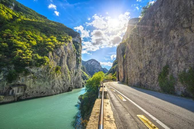
There are two ancient passages cut into the rock at the narrowest point of the gorge, and conflating them is the single most common mistake in anything written about the Furlo. The smaller one — eight meters long, just over three meters wide, four and a half meters tall — is the older of the two; most sources attribute it to the Etruscans, though the reserve’s own historical archive is more cautious, dating it only to sometime between an Augustan-era retaining wall nearby and the larger tunnel that came after it. The second, larger gallery is precisely dated: an inscription above its northeastern entrance records that the emperor Vespasian completed it in 76 or 77 AD, during his seventh year of tribunician power. It runs just over 38 meters through solid limestone, more than five meters wide and nearly six meters tall, cut by chisel with no lining and no reinforcement — and it is still standing, still carrying traffic, nineteen centuries later. The Romans called the pass Petra Pertusa, “the pierced rock,” which over the centuries slurred into Forulum, then Furlo.
I have spent thirty years assessing buildings that needed retrofitting after forty or fifty years of ordinary use. Looking at an unlined tunnel cut by hand through raw limestone that has carried unbroken traffic since the first century — no engineer walks through that without doing the math on how differently we build now, and how rarely modern work is asked to last a tenth as long.
The modern SS3 Flaminia bypasses the gorge entirely, through two tunnels totaling roughly 3.4 kilometers, cut through the hillside in the 1980s specifically to pull car and truck traffic off the historic road. That is the reason you can ride through the old route at all: the new tunnels absorbed the traffic the gorge was never built to hold. As of my research for this piece, the old road inside the gorge carries a curb-separated bike lane distinct from the vehicle carriageway, in place since 2023 — but this stretch of road has a documented history of temporary closures tied to rockfall risk from the limestone walls above it, including full closures in some past years. Check the Riserva Naturale Statale Gola del Furlo’s current notices before you ride; this is not a route detail to assume is unchanged from whatever you read last.
The gorge around the tunnel is a state nature reserve in its own right, established in 2001 and covering roughly 3,600 hectares of the Candigliano river canyon between Monte Pietralata and Monte Paganuccio. A pair of golden eagles nests on the Paganuccio cliff face most years, visible if you stop and look up rather than keep your eyes on the road surface, which through here you will mostly want to do anyway. A short detour near Fossombrone’s Sant’Anna hamlet also leads to an open-air sculpture park set into the old quarry landscape, if you want a reason to get off the bike before the climb.
Bianchello del Metauro: the wine that stayed home
Somewhere between Fossombrone and the gorge, depending on which producer you manage to reach, you can taste the reason this valley has its own DOC. Bianchello del Metauro, recognized since 1969, comes almost entirely from a single grape called Bianchello, or Biancame, grown along a strip of land bounded by the Adriatic on one side and the Cesane hills on the other. Producers closer to the coast describe their wines as brighter and more citrus-forward; those from the inland stretch, cooler and shadier, tend toward something softer and more floral. Beyond the standard dry white, the denomination also permits a Superiore, a spumante, and a rarer passito.
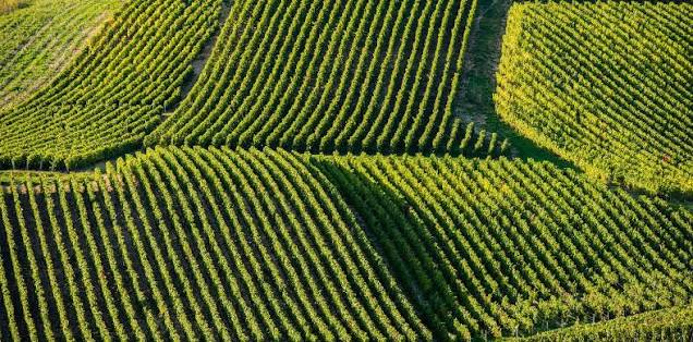
You are unlikely to find a bottle of it outside the province of Pesaro-Urbino, and that absence is not a quality judgment — it is a production scale small enough that most of what is made gets drunk within a short drive of where the grapes were picked. That is, more or less, the whole argument for tasting it here rather than looking for it at home: this is not a wine built for export, and riding through the land it comes from is the only realistic way most Americans will ever taste it. The neighboring Colli Pesaresi DOC, which overlaps this territory and extends toward Urbino itself, adds Sangiovese-based reds and rosatos into the mix, along with a handful of named subzones along the coast.
The climb to Urbino
The last stretch is the one route descriptions warn you about, and they are not exaggerating for effect: several independently logged climbs out of the Fossombrone side of this route report gradients of 16 to 18 percent in sections, with some cyclists’ GPS units recording brief spikes higher still. Starting the ascent a few kilometers past Fossombrone rather than from the town center avoids the steepest opening ramps, which is a small mercy but a real one.
What makes the climb worth the effort is not a single sweeping viewpoint — the approach to Urbino does not offer one — but the way the city arrives all at once, brick towers and the twin turrets of the Palazzo Ducale appearing above the ridgeline after a final bend, having given you no warning it was this close. Federico da Montefeltro built that palace in the fifteenth century to be seen exactly this way: as a reward that announces itself only when you have already earned it, and a far grander sequel to the same duke’s smaller residence you passed in Fossombrone. If you have a full day to give the city once you arrive, I have written about Urbino in more depth elsewhere — what to see inside those towers, and why most Americans have never heard of a city this important.
Planning the ride
The best window is April through June or September, avoiding both the exposed heat of the gorge in high summer and the steeper roads around Urbino in winter conditions. Fano sits directly on the Adriatic coastal rail line and allows free bicycle transport on regional trains, which makes it a straightforward starting point if you are coming from Bologna, Rimini, or Ancona. The return leg is the genuine planning problem: Urbino has no train station of its own — the nearest is Pesaro, roughly 30 kilometers away, reached from Urbino by the regional Adriabus service in about forty-five minutes to an hour. Plan a bus transfer back to the coast, arrange a pickup, or treat the ride as an out-and-back and skip the climb’s reward on the way home.
Bike rental is not centralized the way it is in the Conero or Vallesina wine territories; expect to arrange it directly with a shop in Fano rather than finding a single dominant operator. Several shops in town rent road and e-bikes, and e-bike tours of the gorge itself are also bookable out of Urbino. If your legs are not built for a 16 percent grade with panniers on, an e-bike is not cheating on this particular route — it is the difference between arriving able to enjoy the Palazzo Ducale and arriving only able to look for a bed.
If you want to root the whole valley more deeply in Le Marche’s other wine and cycling territories, or want the truffle detour around Acqualagna on a day when you are not riding, my guide to truffle country covers that ground in more depth than a single paragraph here could. The Frasassi Caves sit roughly an hour south by car, if you want a second engineered marvel — this one made by water instead of Roman chisels — before you leave the province.
—
FAQ — Planning your Metauro Valley ride
What is the Metauro Valley cycling route? It is an inland cycling itinerary in Italy’s Le Marche region, running roughly 55 to 60 kilometers from the coastal city of Fano to the Renaissance hill city of Urbino, following the Metauro River through the Bianchello del Metauro and Colli Pesaresi wine zones and the Gola del Furlo gorge.
When is the best time to ride from Fano to Urbino? April through June or September. Summer brings exposed heat through the gorge sections with little shade, and winter can bring difficult road conditions on the climb toward Urbino.
Do I need to book the wineries or the Furlo tunnel in advance? The Roman tunnel itself requires no booking, but check current access notices from the Riserva Naturale Statale Gola del Furlo before you go, since the gorge road has a documented history of temporary rockfall-related closures. Winery visits in this valley are best arranged by direct phone call rather than assumed as walk-in.
How much does a self-guided version of this ride typically cost? Costs vary by season and by whether you rent a standard or electric bike, so it is worth confirming current daily rental rates directly with a Fano shop before you go rather than relying on a fixed figure here.
How long does the full ride take? Most cyclists in reasonable condition complete it in a single long day, but the Cartoceto detour, a proper stop in Fossombrone, and time inside Urbino itself are enough reason to plan it as an overnight, riding back or by bus the following day.
What should I combine this ride with? Acqualagna’s white truffle season, the Frasassi Caves further south, or a broader look at Le Marche’s other cycling and wine territories all sit within a short drive or ride of this route.
Is the Gola del Furlo road definitely open to cyclists right now? As of this writing, yes, with a curb-separated bike lane distinct from vehicle traffic. But this specific stretch has closed before for rockfall safety work, sometimes for months at a time, so confirm current status with the Riserva before building a trip around it.